3D SCANNING
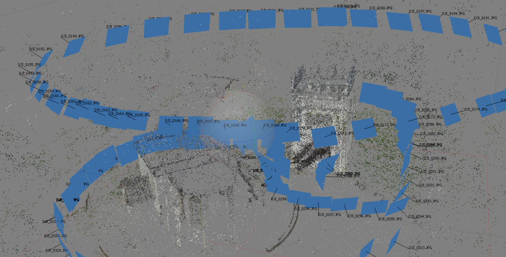
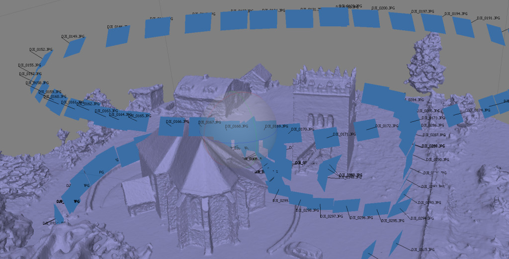
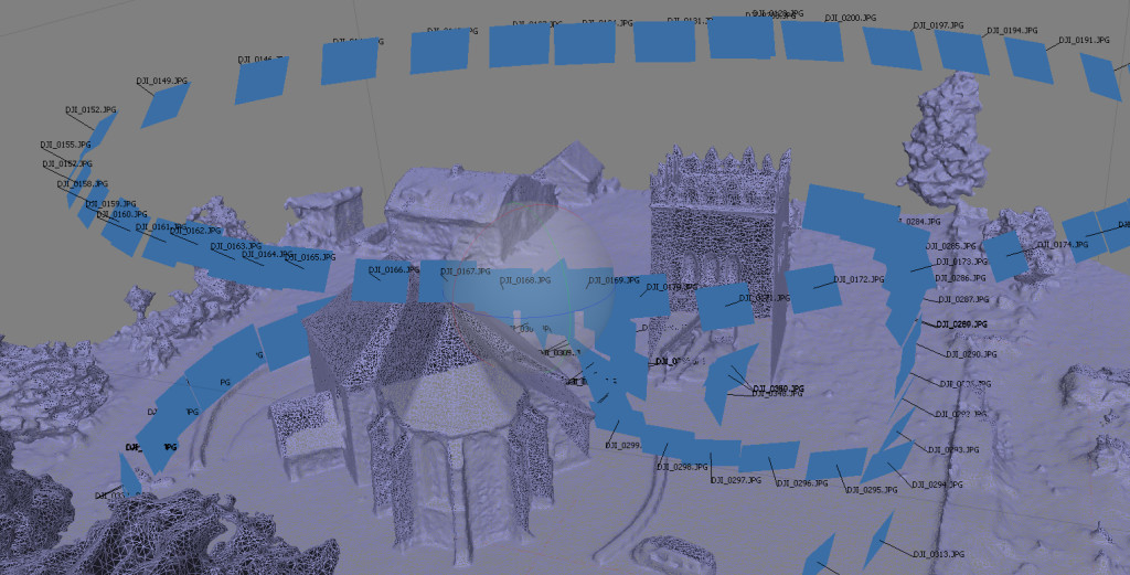
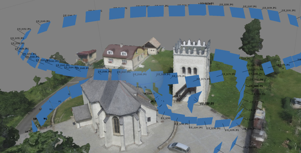
Photogrammetry – 3D scanning is a fast and efficient method for creating 3D models of terrain and with the help of the photographic images captured from different angles, especially from the air. Such digital reconstruction of buildings retain the exact parameters, GPS position and a wide range of data can be drawn from them (eg. Orthomosaic, DEM) with a lot of opportunities. Building models (or whole areas) are used mainly for modernisation, for energy calculations, simulations of fallen precipitation and so on. Equally 3D models of terrain are suitable for accurate visualization of architectural projects, analysis of the accidents or determining the parts of the scanning area (it is a young and growing method of creating 3D model, which is still looking for the new uses).

For further use of generated data and work with them the optimalization of the objects of scenes, involving a simplification of the model into the basic shapes is to be needed (fewer details / poligons), removing the unneeded objects (other buildings, people, cars …) and adding the missing parts of the desirable details (lamps, trees , benches …). This process is individually tailored to the specific requirements of each customer.

